
Cities Attract Hurricanes
City landscapes could draw storms near.
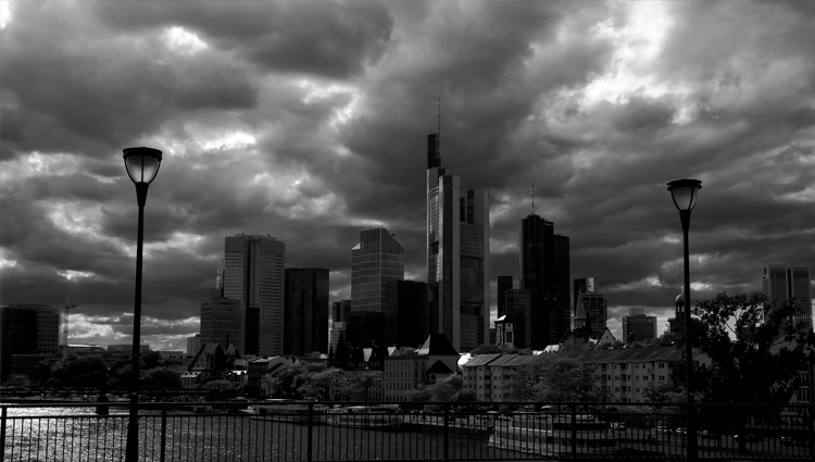
Image
Media credits
WASHINGTON (ISNS) -- Five years ago, Hurricane Katrina slammed into the Gulf Coast, devastating New Orleans and other regions along the Mississippi River Delta. Hurricane forecasting has steadily progressed over the intervening years, which should help cities and states better prepare for devastating cyclones. Now researchers have added another piece to the forecasting puzzle by determining how the texture of landscapes can affect a storm’s motion.
New research shows that rough areas of land, including city buildings and naturally jagged land cover like trees and forests can actually attract passing hurricanes. The research found also that storms traveling over river deltas hold together longer than those over dry ground. As a result, the city of New Orleans might feel a greater impact of hurricanes coming off the Gulf of Mexico than existing computer models predict.
A team from the City University of Hong Kong modeled the effects that different terrain has on the paths of tropical storms to determine how cities that lie in the path of a hurricane change a storm's motion.
"Cities impose greater friction on the swirling flow because of the tall buildings," said Johnny Chan, a professor of meteorology at the university. "Our results show that tropical cyclones tend to be 'attracted' towards areas of higher friction. So it is possible that cities could cause tropical cyclones to veer towards them."
Rough cityscapes and forests trap air. This compresses the air and forces it up into the atmosphere, adding energy to the storm and pulling the center of the hurricane toward the rough region. As a result, a city can cause a hurricane to swerve from its predicted path by as much as 20 miles.
The change is comparatively small for hurricanes that can reach widths of hundreds of miles, but according to Chan, “The main implication from this study is that in any computer prediction of the track of a hurricane, the representation of the land surface is important.”
The researchers also found that river deltas contribute to the longevity of hurricanes. There is more heat-carrying moisture available to evaporate from the wet deltas than dry ground, prolonging the life of the storm.
Chan and Au-Yeung Yee Man developed a computer model to track the movements of a simulated hurricane across varying terrain. Meteorologists have previously incorporated changes in moisture between the sea and land into models, as well as some differences in land formations; however the refinements that Chan and Au-Yeung have developed help reduce the uncertainly in existing models, which improves the planning vital to reducing the losses that accompany Katrina-size storms and the repercussions that follow.
"Its direct applicability to real predictions may be a little bit limited, but I do applaud the idea of looking at the idea of moisture availability and surface roughness," said Bob Tuleya, a retired researcher at the Global Fluid Dynamics Laboratory at the National Oceanographic and Atmospheric Administration who looked at the research, which is slated to be published in the Journal of Geophysical Research.
Chan said the team will continue to refine their models in order to minimize the error before their research can be fully implemented in hurricane predictions. This includes factoring in the effects of the Earth's rotation and other land features such as mountains and jagged coastlines. In addition, the researchers are planning to check their models by looking at the historical records of hurricane paths for any sign of the direction changes that cities would have caused.
Filed under